

Zach & Chase have been the proud owners of The Coby Boathouse since 2017. Originally only looking to purchase a modest cottage in the area, they fell in love with the unique and somewhat quirky waterfront property boasting a century farmhouse and a nearby boathouse nearly equal in size. Suffice to say, they took the plunge.
Previously home to four generations of the same family, going all the way back to pre-Confederation times, Zach & Chase have committed to preserving as many heritage aspects as possible while making practical upgrades. The boathouse was no exception. After making major structural repairs to the foundation and roof, the interior was carefully redesigned over a process of 2 years, including winterizing the upstairs and completely overhauling the plumbing and electrical. Now, the couple are eager to welcome guests to their cozy riverside abode each season, renting it out by the day or the week at competitive rates from mid-May through mid-November.
The Boathouse has 2 bedrooms: A master bedroom with 1 Queen-size bed, and a smaller bedroom with 2 Twin-size beds that, by request, can be put together to form 1 King-size bed.
In the case of extra guests (particularly the younger variety) there is also a Hide-a-Bed in the common area that pulls out from the love-seat.
Enjoy a comfortable stay while getting a complete change of scenery. We offer all the standard amenities you'd expect right on the riverbank, plus a few perks we hope will pleasantly surprise.

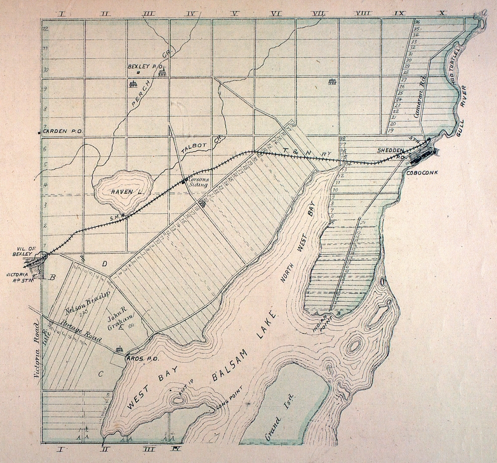
The Village of Coboconk (often shortened affectionately by residents to "Coby") sits at the apex of the Gull River as it empties from Silver Lake to the North into Balsam Lake to the South. All three bodies of water are part of the larger Trent Severn Waterway, a Parks Canada property, and are protected under federal environmental law. The Trent-Severn traverses the famous Canadian Shield geological formation, recording the path of a former glacier over thousands of years. Nearby and noteworthy towns include Haliburton (45 minutes North), Bobcaygeon (30 minutes East) and Fenelon Falls (20 minutes Southeast). Lindsay, the government centre for the City of Kawartha Lakes and host to Ross Memorial Hospital, is a 30-minute drive directly South on Highway 35.
Ecologically, the area is classified as a low-elevation riparian (river) valley, brooched on either side by deciduous forests and marshland. Among the most populous tree species is the Balsam Fir, which gave Balsam Lake its namesake. Various classic Canadian flora and fauna populate the area, including Trillium, Flowering Dogwood, Evening Primrose, Loons, Great Blue Herons, Beavers and River Otters.
Coboconk, like many municipalities within the City of Kawartha Lakes, is home to a dam that meticulously regulates the water levels and speeds of the currents. Because of this, conditions are reliably favourable for boating, fishing, and swimming. Bass fishing is particularly popular in the area, as well as for Pike/Walleye. Thanks to 'evidence' left by otters, we also know that crawfish and freshwater crab are plentiful in our particular area.
Coboconk was once a thriving industrial hub, thanks to the Toronto-Nipissing Railway, laid in 1872. The village played an important role in the urban development of Toronto through shipments of refined materials like lumber and bricks. Originally founded as an encampment for fur traders during the 1700s, by the mid 1800s, Coboconk had attracted various enterprising young men and mercantiles (women were still considered property at the time [eye roll]). However, a series of freak accidents and natural disasters plagued the town in the late 19th and early 20th century—the lumber mill burnt down, the dam broke, and one of the limestone kilns collapsed, killing the workers inside. Eventually, the railroad left too, pulling up stakes in 1965. Since then, the town has been dependent on the tourism industry and investment from cottagers coming from the GTA and Ottawa River Valley.
It should be noted that what we now call Coboconk was inhabited for thousands of years previous by Indigenous people—the Michi Saagiig Anishinaabe, who stewarded and cared for the land and water that we enjoy today. They used the river as a means of transportation as well as a trading and meeting place. In fact, the current name of the town is likely an anglicization of differing Anishnaabeg words meaning place to portage and place where the gulls nest:
In 1859 the village name was anglicized by the establishment of a post office. The name is a translation of the two Indian names for the village, which came from the name of the river: Ko-ash-kob-o-cong, translating to "the part of the river where a portage of a few rods needs to be made" and Quash-qua-be-conk, translating to "where the gulls nest."
—From Wikipedia, «https://en.wikipedia.org/wiki/Coboconk»
The mile-wide peninsula jutting into Balsam Lake, problematically still named Indian Point, was set aside as a reserve for a mixed band of Mississauga and Ojibway peoples, who were in occupation at the time that Canada's infamous "Indian Act" came into effect.